Atlas of Switzerland – interactive
Summary
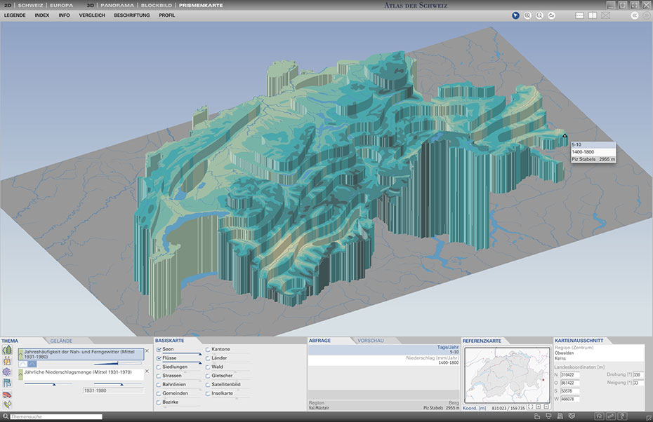
From 2000 to 2010, three interactive versions of Atlas of Switzerland (AoS) were published on CD-ROM/DVD. Atlas of Switzerland 3 contained about 2000 maps with additional time series in 2D maps and 3D mode (block diagrams, prism maps, and panoramic views). It offered a multitude of tools and map functions, including a sky tool, terrain analysis tools, data and map comparison tools, smart legends, and many more (Sieber et al. 2009). The series of interactive AoS was a big success: overall, more than 25,000 copies were distributed during this decade.
Project period
01.01.2000 – 31.12.2010
Researchers
Lead: Hurni, Lorenz
Internal: Sieber, René et.al.
Funding source
Own resources of the professorship
Partner
Bundesamt für Statistik BFS,
Bundesamt für Landestopografie swisstopo
Web
externe SeiteAtlas of Switzerland 3
externe SeiteAtlas of Switzerland 2
externe SeiteAtlas of Switzerland 1